Capture captivating aerial imagery and video with professional-grade drones. Perfect for marketing, real estate, events, and media production. Use cases:
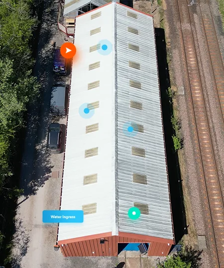
Enviro Drones specialises in conducting detailed aerial inspections of critical infrastructure, industrial facilities, and utility networks, eliminating the need for scaffolding, cranes, or sending personnel into hazardous environments. Our drones can safely navigate challenging areas such as rooftops, tall structures, power lines, wind turbines, and solar farms, capturing high-resolution data with precision.
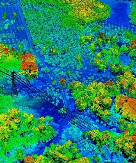
Harness the power of LiDAR technology to gather high-precision, detailed data for a wide range of applications, including terrain mapping, infrastructure planning, and environmental monitoring. LiDAR (Light Detection and Ranging) uses laser pulses to measure distances to the Earth's surface, creating accurate 3D models and maps of the environment with exceptional precision. This technology can penetrate vegetation, measure elevation changes, and provide highly accurate data across diverse landscapes.
Using point cloud data, we generate advanced, highly detailed 3D models that serve as digital replicas of physical spaces. This process captures millions of individual data points, creating a precise and scalable representation of real-world environments. The result is a highly accurate digital twin that can be used for a variety of purposes, from analysis and simulation to design and planning.
Digital twins created from point cloud data allow for virtual inspection and real-time monitoring, enabling stakeholders to test design concepts, optimise workflows, or simulate changes in the environment before making costly physical adjustments. This technology is revolutionizing how complex projects are managed, offering a powerful tool for predictive maintenance, risk assessment, and performance optimisation.